
 Fire Information: Phone: (928) 218-4240 daily from 8 a.m. – 8 p.m.
Email: 2025.whitesage@firenet.gov
Facebook: https://www.facebook.com/BLMArizona and https://www.facebook.com/KaibabNF
InciWeb: https://inciweb.wildfire.gov/incident-information/azasd-white-sage-fire
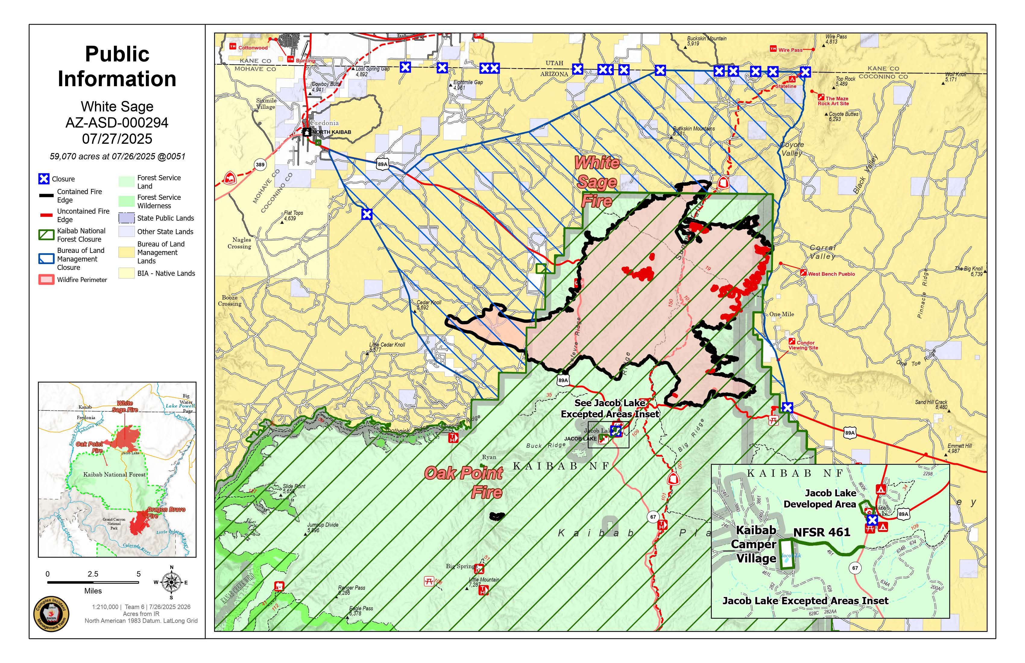
Highlights Highway 89A has been re-opened to the public. The Bureau of Land Management (BLM) Arizona Strip District rescinded the fire area closure near Vermilion Cliffs National Monument today due to decreased fire threat and activity related to the White Sage Fire. Color Country Team 2, a local incident management team, took command of the fire last night. The White Sage Fire is mapped at 58,980 due to improved mapping and unburned interior fuels being consumed. The Oak Point Fire, a small 85-acre fire about 8 miles south of the main fire, is 100 percent controlled. The total acreage reported for the White Sage Fire now reflects both the White Sage and Oak Point Fires. Smoke may be visible from Highway 89A, particularly in the southeast part of the fire near House Rock Valley Road. The smoke is coming from heavier fuels burning in the interior. Those fuels will likely smolder for some time. Throughout the fire footprint, crews are focused on suppression repair, using heavy equipment to move soil and logs back into dozer lines and hand lines. Suppression repair helps to minimize erosion, which can hinder regrowth and water absorption. On the west and south sides of the fire, firefighters are grading roads and spreading seeds appropriate for the area to help the vegetation recover. On the north side, crews are continuing suppression repair along the Winter Road. They are also rebuilding fences that were damaged and re-seeding the area. The east side of the fire is still uncontained due to difficult terrain, but there has been minimal fire activity for several days, so firefighters are patrolling and making sure there is no further movement. Highway 67 remains closed for the Dragon Bravo Fire. For additional information, check the Arizona Department of Transportation website: https://www.az511.com/ Fire Weather The Incident Meteorologist forecasts temperatures in the high 80s, with low humidity and high winds in the afternoon with gusts up to 30 mph. Fire behavior is currently minimal, but any new starts could exhibit extreme fire behavior. Forest Closures Closure information on the Kaibab National Forest is being updated regularly. Up to date information can be found by visiting: https://www.fs.usda.gov/r03/kaibab
|
